What Is a Map? A Simple Guide to Maps and Their Uses
If you have ever looked at a map to find a city, country, road, or mountain, you may have wondered what is a map and why people use one. A map is a visual representation of a place or area. It helps people understand where things are located and how different places connect with each other. Maps can show small areas, such as a neighborhood, or large areas, such as continents and the entire world.
Maps have been used for thousands of years to help people explore, travel, study land, and understand their surroundings. Today, maps are still important in education, transportation, science, business, and everyday life.
What Is a Map?
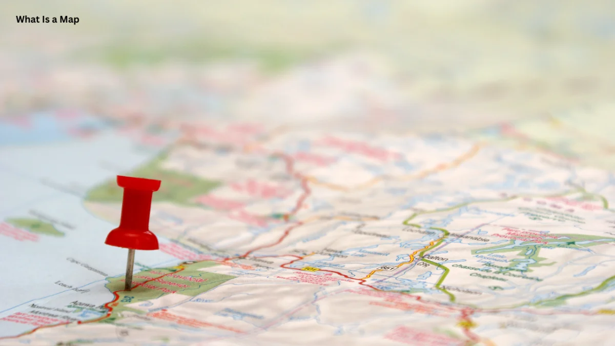
A map is a drawing or visual representation of a geographic area. It uses symbols, lines, colors, labels, and other features to show information about a particular place.
A map does not always show everything that exists in an area. Instead, it focuses on specific information that the map is designed to communicate. For example, a road map focuses on streets and highways, while a weather map shows information about weather conditions.
Maps can represent very small areas or extremely large regions. A simple map may show a school campus, while a world map can show countries, oceans, and continents.
The main purpose of a map is to make geographic information easier to understand.
Why Are Maps Important?
Maps help people understand the world around them. Before modern technology, maps were one of the most important tools for travelers, explorers, sailors, and governments.
Even today, maps play an important role in daily life. People use them when driving to a new location, planning a trip, studying geography, or finding a specific place.
Maps are also useful because they turn complicated geographic information into a visual form. Instead of reading a long description about where places are located, a person can often understand the information quickly by looking at a map.
Students also use maps to learn about countries, continents, rivers, mountains, population, climate, and political boundaries.
How Does a Map Work?
Maps use several visual elements to communicate information. These elements help readers understand what they are looking at.
Symbols
Maps often use symbols to represent real-world features. A small line may represent a road, while a blue line may represent a river. Different symbols can represent airports, cities, schools, parks, or other locations.
Because maps cannot draw every object exactly as it appears in real life, symbols make it easier to show important information.
Labels
Labels are words placed on maps to identify locations. They may show the names of countries, cities, rivers, mountains, streets, or other geographic features.
Clear labels make maps easier to read and understand.
Colors
Colors are commonly used to separate different types of information. For example, blue is often used for water, while green may represent vegetation or lower land areas.
The meaning of colors can change depending on the type of map. This is why readers should always check the map’s legend before interpreting its colors.
Legend
A legend, sometimes called a key, explains the symbols and colors used on a map.
For example, a legend may show that a particular line represents a highway while another symbol represents a hospital. Without a legend, some map symbols may be difficult to understand.
Scale
Map scale shows the relationship between distance on a map and actual distance on Earth.
For example, a map might show that one centimeter represents one kilometer in the real world. Scale is especially important when people need to estimate how far one location is from another.
Main Types of Maps
There are many different types of maps. Each type is created for a particular purpose.
Political Maps
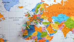
Political maps show boundaries between countries, states, provinces, or other political regions. They often identify capitals and major cities.
Different colors may be used to separate political areas. This makes it easier to see where one country or region ends and another begins.
Political maps are commonly used in classrooms when students learn about countries and world geography.
Physical Maps
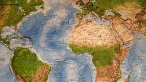
Physical maps show natural features of Earth’s surface. These may include mountains, rivers, lakes, deserts, valleys, and oceans.
Colors are often used to represent differences in elevation. For example, darker or different shades may be used to identify higher areas.
Physical maps are useful for understanding the natural landscape of a region.
Road Maps
Road maps focus on transportation routes. They may show highways, streets, roads, bridges, and important locations along a journey.
Drivers and travelers have traditionally relied on road maps to plan routes. Modern digital navigation systems have made this process faster, but the basic purpose remains the same.
Thematic Maps
Thematic maps focus on one particular subject or theme.
For example, a thematic map might show population density, rainfall, temperature, agricultural production, or economic activity.
Instead of simply showing where places are located, thematic maps help people understand a specific geographic pattern.
Maps vs. Atlases
A map and an atlas are closely related, but they are not exactly the same thing.
A map normally represents a particular geographic area or provides a specific type of geographic information. An atlas is generally a collection of maps organized into a book or another format.
For example, a world atlas may contain separate maps showing different continents, countries, physical features, and political boundaries.
If you want to learn more about the difference between these two resources, you can also explore our guide on What Is an Atlas?
Maps in Everyday Life
Maps are no longer limited to classrooms, libraries, and printed books. Digital maps are now part of everyday life.
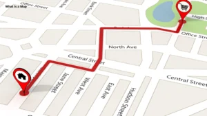
People use map applications to find restaurants, businesses, hospitals, schools, airports, and other locations. Navigation tools can also provide directions and estimate travel times.
Businesses use maps to understand where customers are located. Governments use them for planning roads, public services, and infrastructure. Scientists use specialized maps to study climate, land, oceans, natural resources, and environmental changes.
This makes maps useful far beyond traditional geography lessons.
How Maps Have Changed Over Time
Early maps were often drawn by hand. Their accuracy depended on the information available to the mapmaker.
As explorers traveled to new places and scientists developed better measurement techniques, maps became more detailed and accurate.
The development of satellites, computers, GPS, and geographic information systems changed mapmaking even further. Today, digital maps can be updated quickly and can display large amounts of geographic information.
Modern mapping technology has therefore made maps more interactive and useful than ever before.
How to Read a Map
Reading a map becomes easier when you understand its basic features. Start by checking the title because it tells you what the map is showing.
Next, look at the legend or key. It explains the meaning of symbols, lines, and colors. You should also check the scale if you need to understand distances.
The direction of the map is another important feature. Most maps place north at the top, but you should check the compass or direction indicator instead of assuming it.
By combining these features, you can understand the information a map is designed to show.
What Are the Benefits of Using Maps?
Maps provide several important benefits in education and everyday life.
First, they make locations easier to understand. A person can quickly see where a city, country, river, or mountain is located.
Maps also help people compare places. For example, a world map can help students understand the relative locations of different countries and continents.
Another important benefit is navigation. Maps allow travelers to plan routes and estimate distances between locations.
Maps are also useful for research. Scientists, governments, businesses, and planners can use geographic information to identify patterns and make better decisions.
Maps in Education
Maps are an important part of geography education. Students can use them to learn about Earth’s physical features, political boundaries, population, climate, and natural resources.
A map can also help students develop spatial thinking. Instead of only memorizing the names of places, students can understand how those places are connected.
Teachers may use political maps to teach countries and capitals, physical maps to explain landforms, and thematic maps to demonstrate subjects such as population or climate.
This makes maps a practical learning tool rather than simply a picture of Earth’s surface.
Digital Maps and Modern Technology
Technology has changed how people create and use maps. Digital maps can provide information almost instantly and can often be updated when roads, buildings, or other features change.
GPS technology allows devices to determine a user’s location and provide directions. Digital mapping platforms can also show traffic conditions, satellite imagery, public transportation, and nearby businesses.
Geographic Information Systems, commonly called GIS, take digital mapping even further. GIS allows users to collect, organize, analyze, and display geographic information.
These technologies are widely used in transportation, environmental research, urban planning, emergency management, and many other fields.
What Is the Difference Between a Map and a Globe?
A map and a globe both represent Earth, but they do so in different ways.
A globe is a three-dimensional model of Earth. Because it has a shape similar to Earth, it can represent the planet’s overall form without flattening its surface.
A map is usually flat. This makes it easier to carry, print, display, and use for detailed information. However, transforming Earth’s curved surface onto a flat map can create some distortion.
Neither tool is better for every purpose. A globe can provide a useful view of Earth’s overall shape, while maps are often more practical for studying specific regions or geographic information.
What Is Map Projection?
A map projection is a method used to represent Earth’s curved surface on a flat map.
Because Earth is roughly spherical and a map is flat, some form of distortion is unavoidable when creating a flat representation of the planet.
Different projections are designed for different purposes. Some preserve distances more accurately in certain areas, while others focus on shapes, directions, or areas.
Understanding map projections is important when interpreting world maps because the size or shape of geographic features may appear different depending on the projection used.
Common Mistakes When Reading Maps
One common mistake is ignoring the legend. A symbol or color may not mean what you expect, so checking the key is important.
Another mistake is assuming that every map uses the same scale. A small local map and a world map can have very different scales.
People may also forget that maps can simplify or distort geographic information. A map is a representation of reality, not a perfect copy of the real world.
Finally, readers should pay attention to the date of a map when current information matters. Political boundaries, roads, populations, and other geographic details can change over time.
Why Maps Still Matter Today
Even with smartphones and digital navigation, maps remain important. Modern technology has changed the way maps are created and accessed, but it has not removed their value.
Maps help people understand locations, patterns, distances, and relationships between places. They support education, travel, scientific research, business planning, and public services.
Learning how to read a map also gives people a better understanding of geography and the world around them.
Frequently Asked Questions
What is a map in simple words?
A map is a visual representation of a geographic area. It uses symbols, colors, labels, and other features to show locations and geographic information.
What are the main types of maps?
Common types include political maps, physical maps, road maps, and thematic maps. Each type focuses on different geographic information.
What is the purpose of a map?
The main purpose of a map is to communicate information about locations, distances, directions, boundaries, physical features, or geographic patterns.
Why are maps important for students?
Maps help students understand geography visually. They can make it easier to learn about countries, continents, landforms, cities, climate, and other geographic subjects.
What is the difference between a map and an atlas?
A map usually represents a specific area or geographic subject. An atlas is a collection of maps organized together, often covering different regions or topics.
Are digital maps more accurate than paper maps?
Digital maps can be highly detailed and can receive frequent updates, but accuracy depends on the data and mapping system being used. Paper maps can also be accurate when they are based on reliable and current information.
Conclusion
So, what is a map? It is a visual tool that helps people understand geographic locations and information. From simple road maps to detailed scientific maps, different maps serve different purposes.
Maps have been important throughout human history, and modern technology has made them even more useful. Digital mapping, GPS, satellite imagery, and GIS now allow people to explore and analyze geographic information in ways that were once impossible.
Whether you are a student learning geography or a traveler finding a new destination, understanding how maps work can help you make better sense of the world around you.
- U.S. Geological Survey (USGS) — Maps & Mapping
USGS Maps & Mapping - National Geographic Society — Maps
National Geographic: Maps - Library of Congress — Maps
Library of Congress: Maps - Britannica — Map
Encyclopaedia Britannica: Map - USGS — What Is GIS?
USGS: Geographic Information System