
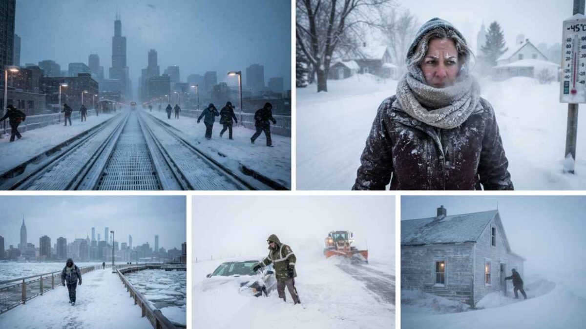
Polar Vortex 2026: What It Could Mean for Winter Weather
The polar vortex 2026 discussion is already getting attention as the Northern Hemisphere moves toward winter. People want to know whether it could bring severe cold, snow, or sudden winter storms.
The polar vortex is not a new storm. It is a large circulation of cold air around the polar region. It becomes stronger during winter and can sometimes shift or weaken.
So, what is the polar vortex 2026 expected to do? That question cannot be answered with one exact forecast yet. The atmosphere is changing all the time, and several weather patterns can affect the final outcome.
One important factor this year is El Niño. NOAA said in September 2026 that El Niño is strengthening and has more than a 90% chance of becoming a very strong event during the Northern Hemisphere fall and winter. (Climate Prediction Center)
That does not mean every place will have the same winter. It also does not mean a polar vortex disruption will definitely happen. Instead, scientists are watching several signals together to understand how winter conditions may develop.
Polar Vortex 2026: What Is Happening Now?
The polar vortex is forming for winter
The polar vortex exists around the poles every year. It becomes more important during the colder months because the temperature difference between the polar region and lower latitudes helps strengthen the circulation.
The National Weather Service explains that the polar vortex is a large area of low pressure and cold air around the Earth’s poles. During Northern Hemisphere winter, it can expand and allow Arctic air to move farther south. (National Weather Service)
It is important to understand that the polar vortex is not sitting on the ground like a normal storm. Much of the circulation being discussed by scientists occurs high in the atmosphere, especially in the stratosphere.
That is why a strong polar vortex does not automatically mean a cold wave is coming to a city. The connection between the upper atmosphere and surface weather depends on several other patterns.
Why scientists are watching the vortex in 2026
Scientists are watching the polar vortex because changes in its strength can sometimes influence the jet stream and winter weather patterns.
A strong and stable vortex can help keep very cold Arctic air closer to the polar region. A disturbed vortex can become stretched, displaced, or split. In some cases, this can change the atmospheric circulation farther south.
NOAA explains that disruptions of the stratospheric polar vortex can be followed by cold-air outbreaks in parts of the middle latitudes. However, the timing and location of those effects are not guaranteed. (Climate.gov)
This distinction matters for the polar vortex 2026 forecast. A weakening signal high in the atmosphere does not automatically translate into extreme cold everywhere.
El Niño adds another major weather signal
The biggest background climate signal this winter is El Niño.
NOAA’s September 10, 2026 ENSO discussion reported that El Niño is strengthening. The agency said there is greater than a 90% chance of a very strong event during the Northern Hemisphere fall and winter of 2026–27. (Climate Prediction Center)
NOAA also reported that the October–December 2026 period has a 75% chance of an El Niño event reaching a level that would rank among the strongest events recorded since 1950. (Climate Prediction Center)
El Niño affects large-scale atmospheric circulation. That can influence storm tracks, precipitation, and temperature patterns in different parts of the world.
But El Niño does not control the polar vortex by itself. The atmosphere contains many interacting systems. The Arctic Oscillation, North Atlantic Oscillation, jet stream, stratospheric winds, ocean temperatures, and other factors can all affect winter weather.
How a Polar Vortex Disruption Can Change Weather
The jet stream can become more wavy
The jet stream is one of the most important links between the upper atmosphere and surface weather.
When the circulation becomes highly wavy, cold Arctic air can move south in some regions while warmer air moves north in others.
This can create very different temperatures across relatively short distances. One area may experience a cold outbreak while another region is unusually mild.
That is one reason a polar vortex event should not be described simply as “the whole Northern Hemisphere will freeze.”
The National Oceanic and Atmospheric Administration has noted that changes in the jet stream can play an important role when the polar vortex becomes disrupted. (PMEL)
Sudden stratospheric warming can weaken the vortex
One of the terms often connected with polar vortex stories is sudden stratospheric warming, or SSW.
An SSW happens when the stratosphere experiences a rapid warming event. Strong atmospheric waves can move upward from lower levels and disturb the circulation around the pole.
When this happens, the polar vortex can weaken or become displaced.
However, an SSW does not guarantee an immediate snowstorm. There can be a delay between a stratospheric event and changes in surface weather.
Scientists therefore watch the atmosphere for several weeks after a major disruption rather than assuming that one event will produce the same result everywhere.
Cold weather does not always mean a polar vortex event
This is one of the most common misunderstandings.
A very cold week can happen for many reasons. Local weather patterns, high-pressure systems, snow cover, jet-stream changes, and other atmospheric conditions can all contribute.
NOAA’s National Environmental Satellite, Data, and Information Service also stresses that not all cold weather is caused by the polar vortex. (NOAA Satellite Service)
The same point applies in reverse. A polar vortex disturbance does not guarantee record-breaking cold.
For people following the polar vortex 2026, the useful question is therefore not simply whether the vortex exists. It always exists. The better question is whether it becomes disturbed in a way that affects lower-atmosphere weather.
What Could Polar Vortex 2026 Mean for the United States?
Northern and central states could see sharper cold risks
If the polar circulation becomes disturbed and the jet stream develops a favorable pattern, parts of the United States could experience Arctic air outbreaks.
The strongest effects would depend on the exact position of the jet stream and other pressure systems.
The northern United States and parts of the Midwest can be particularly exposed to Arctic air because of their geographic position.
However, it would be too early in September 2026 to assign specific temperatures or snowfall totals to a future polar vortex event.
The Northeast could see changing winter conditions
The Northeast can experience major temperature swings during winters with large-scale jet-stream changes.
A disrupted pattern can sometimes allow cold air to move into the eastern United States. If moisture and storm systems arrive at the same time, snow or freezing conditions can become possible.
But temperature and precipitation are separate forecast questions.
A cold pattern does not automatically mean heavy snow. A storm also needs the right moisture, track, atmospheric temperatures, and timing.
Western states may follow a different pattern
The western United States can respond differently to large-scale atmospheric changes.
Pacific Ocean conditions and the position of high- and low-pressure systems can influence the region. El Niño can also shift storm-track patterns.
This means the effects of the polar vortex 2026 cannot be reduced to one national forecast.
Regional weather may vary considerably even during the same large atmospheric event.
Could Polar Vortex 2026 Affect Europe?
Europe can also experience Arctic air outbreaks
The polar vortex is not limited to the United States.
Europe and parts of Asia can also experience cold-air outbreaks associated with changes in the polar circulation and jet stream. The National Weather Service notes that polar-vortex-related cold surges can affect parts of Europe and Asia as well as North America. (National Weather Service)
The exact European impact depends heavily on the position of the jet stream and pressure patterns over the Atlantic and Europe.
A weakened or displaced vortex may therefore have very different consequences from one winter to another.
Snowfall is harder to predict than temperature
People often connect the words “polar vortex” and “snow.”
The connection is not automatic.
Very cold air can arrive without a major snowstorm. Heavy snow requires moisture and a suitable storm track.
For that reason, a polar vortex forecast should be treated as one piece of the winter-weather puzzle rather than a complete snowfall forecast.
What Scientists Know About Polar Vortex and Climate Change
A warmer climate does not mean cold waves disappear
Climate change and short-term winter weather can exist at the same time.
The planet can experience long-term warming while individual regions still experience periods of extreme cold.
NOAA research has examined whether Arctic warming and reduced sea ice could influence jet-stream behavior and polar-vortex variability. Scientists have discussed possible connections, but the relationship remains complex. (Climate.gov)
The evidence does not support a simple claim that climate change will automatically produce more polar vortex disruptions every year.
In fact, a NOAA scientific assessment reported that there is currently no evidence for a systematic trend toward more frequent polar vortex disruptions in either hemisphere. (NOAA Chemical Sciences Laboratory)
Arctic changes are still important
The Arctic has warmed faster than the global average in many periods, and the region has experienced major changes in sea ice.
Those changes can affect the atmosphere. But scientists are still studying how those changes interact with the polar vortex, jet stream, and surface weather.
This is why careful language is important when discussing the polar vortex 2026.
It is reasonable to monitor the relationship. It is not reasonable to turn an uncertain scientific connection into a guaranteed forecast.
For a broader look at how changing temperatures affect wildlife, readers can also explore NexaVice’s Climate Change Effects on Animals article.
What to Watch During Winter 2026–27
Stratospheric wind strength
Scientists will monitor the winds surrounding the polar region.
A strong circulation can keep cold air more contained. A weakening circulation can increase the possibility of major changes in the polar atmosphere.
Sudden stratospheric warming
An SSW event would become an important development if it occurs.
But the event itself would not tell forecasters exactly where cold weather will appear. Researchers would need to monitor the atmospheric response afterward.
Jet stream position
The jet stream will be crucial for determining where Arctic air moves.
Its position can change quickly. This is why short- and medium-range forecasts become more useful as a potential event gets closer.
El Niño strength
El Niño will also remain an important factor through the winter.
NOAA’s current September outlook shows a very strong El Niño signal for late 2026 and early 2027. (Climate Prediction Center)
Researchers will continue updating the outlook as new observations become available.
Official weather forecasts
For anyone tracking possible winter impacts, official forecasts are more useful than social-media claims.
The National Weather Service provides information about cold hazards and the polar vortex through its weather-safety resources. (National Weather Service)
NOAA’s Climate Prediction Center also publishes updated seasonal outlooks and ENSO information throughout the year. (Climate Prediction Center)
How to Prepare for a Major Cold Outbreak
Check forecasts before the cold arrives
A polar vortex headline does not mean immediate danger.
People should follow local weather forecasts and official warnings. Conditions can change as the event develops.
Protect homes and vehicles
During severe cold, exposed pipes, heating systems, batteries, and vehicles can become vulnerable.
Basic winter preparation can reduce problems when temperatures drop suddenly.
Protect people and animals
Very cold weather can be dangerous for people and animals.
Pets should have a warm and safe place to stay. Outdoor animals may also need protection from freezing temperatures, wind, and limited access to food or water.
Wildlife faces different challenges during extreme weather. Cold conditions can affect food availability and movement, especially when combined with snow and ice.
Readers interested in marine wildlife protection can also see NexaVice’s Saving Whales in San Francisco article.
Polar Vortex 2026 FAQs
Will the polar vortex happen in 2026?
The polar vortex already exists around the poles and becomes stronger during winter. The important question is whether it will become unusually disturbed or displaced during the 2026–27 winter.
Will polar vortex 2026 cause a major freeze?
It is too early to say. A disrupted polar vortex can increase the potential for Arctic air outbreaks, but the final weather depends on the jet stream and other atmospheric patterns.
Is the polar vortex caused by climate change?
No. The polar vortex is a normal atmospheric circulation pattern. Scientists are studying whether Arctic climate changes can influence its behavior, but the relationship is complex.
Does a weak polar vortex mean more snow?
Not necessarily. Snow requires moisture and the right storm track. A weak or disturbed vortex can influence temperature patterns without producing major snowfall everywhere.
What is the biggest weather signal for winter 2026–27?
El Niño is one of the major signals currently being monitored. NOAA’s September 2026 outlook indicates a very strong El Niño is highly likely during the Northern Hemisphere fall and winter. (Climate Prediction Center)
Conclusion
The polar vortex 2026 is worth watching as winter approaches, but it should not be treated as a guaranteed forecast of extreme cold.
The vortex is a normal part of the polar atmosphere. What matters is how its strength and position interact with the jet stream and other weather systems.
This winter also has a strong El Niño signal. NOAA’s latest September assessment points to a very strong El Niño during the 2026–27 winter, but that does not determine the weather for every region. (Climate Prediction Center)
The most useful approach is to follow how the stratosphere, jet stream, Arctic conditions, and El Niño develop together.
As winter gets closer, forecasts will become more specific. For now, the science supports watching the signals rather than assuming that a major polar vortex event is guaranteed.

[…] Breaking Sudden Stratospheric Warming 2026: Could Winter Shift?Polar Vortex 2026: Is a Colder Winter Coming?What Is an AI Design Agent for Creative Workflows?AI Agent vs Chatbot: 7 Key Differences […]