Sudden Stratospheric Warming 2026: Why It Could Change Winter
Sudden Stratospheric Warming 2026 could become an important weather topic during the 2026–27 winter. The event happens high above the Arctic, far above the clouds where normal weather develops. Even though the warming occurs in the stratosphere, it can sometimes affect weather patterns closer to the ground.
The name can also be confusing. A sudden stratospheric warming does not mean that people at the surface will suddenly feel warmer. The term describes a rapid temperature rise in the stratosphere, where temperatures can increase by around 50°C within only a few days during a major event. (Met Office)
The bigger concern is what happens to the winds around the Arctic after this warming. These winds are part of the stratospheric polar vortex. When they become weaker or change direction, the disturbance can sometimes move downward and influence the jet stream.
That does not mean every SSW event produces a major freeze. Some events have a stronger effect on surface weather than others. The final outcome depends on the shape of the atmosphere and how other weather patterns develop at the same time.
For winter 2026–27, scientists will continue watching the stratosphere, polar vortex and jet stream together. There is also a strong El Niño developing in the Pacific, which adds another important factor to the wider seasonal weather picture. NOAA said in September 2026 that there was a greater than 90% chance of a very strong El Niño during the Northern Hemisphere fall and winter. (Climate Prediction Center)
Sudden Stratospheric Warming 2026: What Could Happen This Winter
What Is Sudden Stratospheric Warming?
Sudden stratospheric warming is a rapid temperature increase in the stratosphere during the Northern Hemisphere winter. The stratosphere begins roughly 10 kilometers above Earth’s surface and extends much higher into the atmosphere.
During a major SSW event, the temperature can rise very quickly. The Met Office says the increase can reach about 50°C in only a few days. This warming takes place so high above the surface that people do not directly feel it. (Met Office)
The important part is not the warming itself. Scientists are more interested in how the warming changes the circulation around the Arctic. Those changes can eventually affect the jet stream and surface weather.
This is why SSW events receive attention during winter. A disturbance high in the atmosphere can sometimes create a chain of changes that reaches much lower levels.
The Connection Between SSW and the Polar Vortex
The stratospheric polar vortex is a large circulation of cold air and strong winds around the Arctic. During winter, powerful westerly winds normally circle the pole high in the stratosphere.
These winds help keep the cold polar air contained around the Arctic. But the circulation is not always stable. Large atmospheric waves can disturb the vortex and weaken its winds.
During a major SSW, those winds can become much weaker or even reverse direction. NOAA describes major SSWs as rapid polar-stratosphere warming events associated with a reversal of the normal wintertime westerly winds. (NOAA Chemical Sciences Laboratory)
That is where the connection with Polar Vortex 2026 becomes important. A change in the stratospheric vortex can influence the wider atmospheric pattern, although the surface response is not guaranteed.
How Does an SSW Develop?
The process starts with large waves in the atmosphere. These waves can travel upward from the lower atmosphere into the stratosphere.
When they interact with the polar vortex, they can disturb its normal circulation. The winds may slow down and, during a major event, reverse from west-to-east flow to east-to-west flow.
The air in the polar region can then move downward and become compressed. Compression causes the air to warm rapidly. This produces the sudden temperature rise that gives the event its name.
The process is complex, but the basic idea is easier to understand when the atmosphere is viewed as a connected system. Changes in one layer can influence another layer over time.
Why Does an SSW Matter for the Jet Stream?
The jet stream is one of the main reasons an SSW can become important for surface weather. It is a fast-moving band of air that helps guide weather systems across the Northern Hemisphere.
After some major SSW events, the jet stream can become more wavy. Instead of moving in a fairly smooth west-to-east path, it can develop large northward and southward bends.
Those bends can change where cold Arctic air and warmer air move. They can also help create areas of high pressure that block normal weather systems.
The Met Office explains that an SSW can sometimes make the jet stream more wavy and create blocking high pressure, especially around the North Atlantic and Scandinavia. (Met Office)
Could It Bring Extreme Cold?
An SSW can be followed by colder weather in some regions, but it should not be treated as a guaranteed cold-weather warning.
The reason is simple. The atmosphere has many moving parts. Even if the polar vortex becomes disturbed, the resulting surface pattern depends on the location and strength of the disturbance.
Some past SSW events have been followed by major cold outbreaks. NOAA research also documents links between disrupted stratospheric polar vortex events and extreme cold outbreaks in parts of North America and Eurasia. (Climate.gov)
Other SSW events have produced a much weaker surface response. The Met Office also notes that an SSW does not happen every year and does not always affect surface weather when it does occur. (Met Office)
So, the useful question is not simply whether an SSW happens. Forecasters also need to know whether the disturbance reaches the lower atmosphere and what the jet stream does afterward.
Could Europe See Colder Weather?
Europe is one region that can sometimes experience noticeable weather changes after a major SSW.
A disturbed polar vortex can contribute to a more wavy jet stream. In some situations, high pressure can become established over areas such as Scandinavia or the North Atlantic.
That pattern can allow colder air to move into northern parts of Europe. In some cases, easterly winds can bring colder continental air toward western Europe.
Snow is also possible when cold air meets the right moisture and pressure pattern. However, an SSW by itself does not guarantee widespread snow.
The 2018 European cold spell is one well-known example of a major cold event that followed an SSW. But past events should not be treated as a promise that the same pattern will repeat in 2026–27. (Met Office)
What About the United States and Canada?
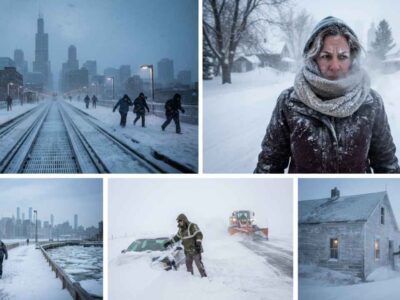
North America can also experience changes after major polar vortex disruptions. A weaker or displaced vortex can sometimes help create a jet-stream pattern that allows Arctic air to move farther south.
This can contribute to sharp temperature drops in some parts of the United States or Canada. However, the exact location of the cold air depends on the complete atmospheric setup.
NOAA’s historical SSW research includes surface impacts such as extreme cold-air outbreaks across North America and Eurasia. (NOAA Chemical Sciences Laboratory)
That does not mean every North American winter cold spell is caused by an SSW. Cold weather can develop from many other atmospheric patterns.
This distinction is especially important when reading long-range winter forecasts. A single polar-vortex chart cannot tell the full story.
What Role Could El Niño Play?
The 2026–27 winter has another major climate signal to watch: El Niño.
NOAA’s September 10, 2026 ENSO discussion said El Niño was strengthening. It also gave a greater than 90% chance of a very strong event during the Northern Hemisphere fall and winter of 2026–27. (Climate Prediction Center)
El Niño and sudden stratospheric warming are not the same thing. El Niño develops from changes in tropical Pacific Ocean temperatures and the atmosphere above them. SSW events develop much higher in the atmosphere around the polar region.
However, large-scale atmospheric patterns can interact. That means forecasters may consider several signals when looking at the coming winter.
El Niño does not prove that an SSW will happen. An SSW also does not require El Niño. They are separate processes that can exist during the same winter.
Is an SSW Caused by Climate Change?
This is one area where it is important to avoid simple claims.
The polar atmosphere is affected by many natural processes. Scientists continue to study how a changing climate may influence the polar vortex and stratospheric circulation.
Current research does not support a simple statement that climate change automatically causes more sudden stratospheric warming events. NOAA’s discussion of the Arctic polar vortex also notes that there is no clear long-term trend showing that the vortex is becoming consistently more disrupted. (Climate.gov)
This does not mean climate change has no connection to atmospheric circulation. It means the specific relationship between long-term warming and individual SSW events is complicated.
For a broader look at how a changing climate can affect wildlife, see Climate Change Effects on Animals.
When Can Scientists Predict an SSW?
Predicting an SSW is difficult because the event depends on several interacting atmospheric processes.
Weather agencies use observations from satellites, weather stations and atmospheric measurements. Computer models are also used to monitor changes in temperature, pressure and wind patterns high above the Arctic.
Forecast confidence improves as an event gets closer. The Met Office says individual SSW events can currently be predicted with useful reliability about a week in advance. (Met Office)
The effects at the surface can take longer to appear. In some cases, an SSW may influence surface weather a few weeks after the stratospheric warming begins.
This time gap is one reason why early winter headlines can be misleading. A possible stratospheric signal does not automatically tell us what a specific city will experience several weeks later.
What Should We Watch During Winter 2026–27?
The strength of the polar vortex will be one important signal. Scientists will watch whether the strong winds around the Arctic remain stable or begin to weaken.
The position of the vortex will also matter. A displaced vortex can create a different weather pattern from a split vortex.
The jet stream will be another major piece of the puzzle. Forecasters will look for large waves, blocking patterns and changes in the movement of Arctic air.
Surface pressure patterns will also help show whether a stratospheric disturbance is having a meaningful effect below.
NOAA’s official seasonal outlook system already includes forecasts for periods such as November 2026 through January 2027 and December 2026 through February 2027. These forecasts will continue to be updated as new information becomes available. (Climate Prediction Center)
Can an SSW Affect Wildlife?
A major change in winter weather can affect wildlife, but the impact depends heavily on the species and location.
Some animals are well adapted to cold temperatures. Others depend on stable seasonal conditions for food, movement and shelter.
A sudden cold outbreak can make food harder to find. Heavy snow can cover vegetation. Ice can also change access to water and feeding areas.
These effects can become more serious when extreme weather occurs alongside habitat loss, pollution or other environmental pressures. That is why weather events should be viewed as one part of a much larger ecosystem.
For readers interested in marine wildlife protection, Saving Whales in San Francisco covers a different but related environmental issue involving whale conservation.
Why an SSW Does Not Guarantee a Major Freeze
One of the biggest mistakes in winter-weather coverage is treating an SSW as a direct forecast for a major freeze.
The relationship is more complicated. An SSW changes conditions high in the atmosphere, but the surface response depends on what happens afterward.
The jet stream may become more wavy. High-pressure blocking may develop. Cold air may move into some areas while other regions remain relatively mild.
This means two different SSW events can produce very different weather outcomes.
A useful winter forecast therefore needs more than the words “polar vortex” or “sudden stratospheric warming.” It needs to explain where the atmospheric changes are happening and how they are affecting the lower atmosphere.

Frequently Asked Questions
What is sudden stratospheric warming?
Sudden stratospheric warming is a rapid rise in temperature high in the stratosphere during winter. It can also disturb the strong winds surrounding the Arctic polar region.
Can sudden stratospheric warming cause snow?
It can contribute to weather patterns that bring cold or snowy conditions to some areas, but it does not guarantee snow. The final outcome depends on the jet stream and other weather systems.
Is Sudden Stratospheric Warming 2026 confirmed?
A future SSW event should not be called confirmed simply because a long-range model shows a possible signal. Scientists need to monitor actual atmospheric conditions as winter develops.
How long can an SSW affect weather?
The surface effects can take several days or weeks to develop. The timing varies between events, and some SSWs have little noticeable effect at the surface. (Met Office)
Does an SSW destroy the polar vortex?
Not necessarily. A major SSW can weaken, displace or split the stratospheric polar vortex, but the exact response depends on the event.
Could an SSW affect the United States?
Yes, it can contribute to atmospheric patterns that allow Arctic air to move farther south. But it does not guarantee extreme cold across the United States.
Does El Niño cause sudden stratospheric warming?
No. El Niño and SSW are different atmospheric and climate processes. They can occur during the same winter, but one does not automatically mean the other will happen.
Is sudden stratospheric warming caused by climate change?
There is no simple scientific basis for saying that climate change directly causes more SSW events. The relationship between climate change and polar-vortex behavior remains an active research topic. (Climate.gov)
Conclusion
Sudden stratospheric warming is one of the most interesting winter processes because a rapid change high in the atmosphere can sometimes influence weather much closer to the ground.
For Sudden Stratospheric Warming 2026, the key point is that the event should not be treated as a guaranteed prediction of a severe winter. Scientists will need to see how the polar vortex behaves, whether the jet stream changes, and whether the disturbance moves down into the lower atmosphere.
The 2026–27 winter also has a strong El Niño signal. NOAA currently expects a very strong El Niño during the Northern Hemisphere fall and winter, but even that does not determine the exact weather for every location. (Climate Prediction Center)